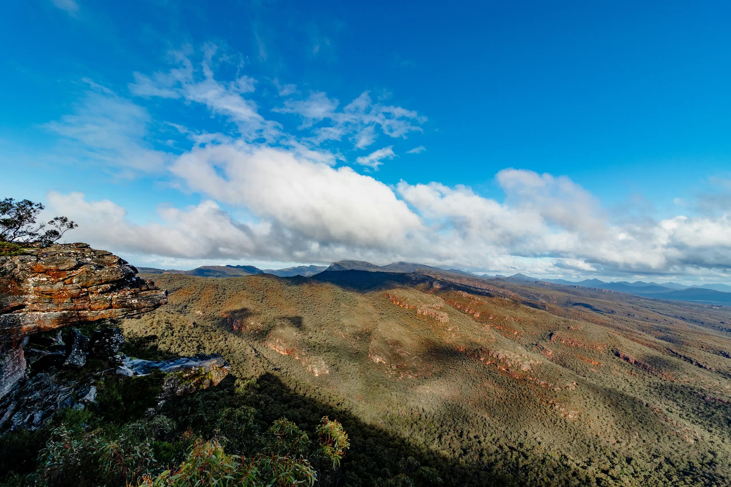
View from a sandstone clifftop across forested ridges and distant ranges in Gariwerd, the Grampians

Flagship long day · Melbourne to Gariwerd

Grampians (Gariwerd) day trip from Melbourne, with your own car and driver.

Six hours of driving. Worth every kilometre — if you’re not the one driving.

260 km

Each way

12–14 hrs

Private hire

5

Rock art shelters open

  1. Melbourne
  2. Ballarat
  3. Ararat
  4. Stawell
  5. Halls Gap
  6. The Pinnacle
  7. The Balconies

The Grampians — Gariwerd — is about 260 kilometres west of Melbourne, roughly three hours each way via the Western Freeway to Stawell. It is a National Heritage listed sandstone range holding Victoria's greatest concentration of Aboriginal rock art, a 164-kilometre long-distance walking trail, and some of the state's best clifftop lookouts. ME CABS runs it as a private 12 to 14 hour hire: we check the current road and closure report for your date, and you spend the day looking at it rather than driving to it.

Gariwerd is the Aboriginal name for this range, and we use it here alongside Grampians. The Djab Wurrung and Jardwadjali peoples have lived here for tens of thousands of years, and Gariwerd sits at the centre of creation stories for many communities across south-western Victoria. We acknowledge them as Traditional Owners, and pay respect to Elders past and present.


Before you book

A day trip is not enough to see Gariwerd.

This is the longest trip in our range and the only one where the drive genuinely competes with the destination. A day trip is around 520 kilometres of driving, leaving roughly five to seven hours in the park. That is enough for two or three lookouts, one real walk and a rock art site — a good day, and a real one. It is not enough to see the Grampians.

The better version is an overnight in Halls Gap or Dunkeld, which turns the same drive into two full days. We would rather tell you that now than sell you a day that leaves you disappointed. Ask us about it when you enquire.

12-hour day

Driving
~6 hours
In the park
~5 hours

Two lookouts, one moderate walk, one rock art site.

14-hour day

Driving
~6.5 hours
In the park
~7 hours

Adds a second walk, or the northern rock art shelters.

Overnight

Driving
Same drive, split
In the park
Two full days

Sunrise at The Pinnacle, the southern peaks, the western rock art.

What's open in Gariwerd

The most important section on this page.

No other destination we serve changes this often. Parks Victoria publishes a dated road report and a change-of-conditions page, and both are read before your day is confirmed and again on the morning you travel.

Is MacKenzie Falls open?

Checked 25 August 2026

No. The entire MacKenzie Falls precinct — the car park, Broken Falls Walk, the walk to the base, Bluff Lookout and parts of the River Walk — closed on 9 February 2026 for major construction including a new viewing platform at the base, with works expected to run to the end of 2026. There is no vehicle or pedestrian access. Silverband Falls is the working alternative, and it is open.

MacKenzie Falls precinct

Closed since 9 Feb 2026, expected to end of 2026

No vehicle or pedestrian access. We substitute Silverband Falls.

Brambuk Cultural Centre

Building closed for refurbishment

The Information Centre entry building remains open. Parks Victoria is working with a partnership of Gariwerd Traditional Owners on its future.

Mount Zero (Mura Mura) trailhead

Upgrade complete — car park reopened with more parking

Day parking is available again at the trailhead, with new picnic facilities and signage. Other sources still list it as closed.

Mount William Summit Walk & Major Mitchell Plateau Circuit

Closed for bushfire damage

Not walkable. The Pinnacle and the northern walks are unaffected.

Zumsteins parking

Limited during MacKenzie works

Difficult for larger vehicles on weekends and holidays.

Sundial Peak Walk & The Bleachers

Closed for bushfire track damage

The Pinnacle Walk and Lakeview Lookout from the same car park remain open.

Grampians Peaks Trail

Fully reopened 2 March 2026

All 164 kilometres open for the first time since the fires, with five rebuilt hike-in campgrounds.

Seasonal road closures

In place 9 June – 29 Oct 2026

Affects unsealed and remote roads, including western access.

Roadworks

Rolling closures on Glenelg River Rd, Lodge Rd and others

Detours change month to month — we read the current road report.

Planned burns

Scheduled through autumn

Temporary closures of tracks, roads and sites, typically for the burn plus 12 to 24 hours.

Total Fire Ban days

Park sites can close at short notice

We agree a contingency with you when we quote, so the plan is settled before you travel.

The current road report at Parks Victoria

We read the Parks Victoria road and closure report for Gariwerd before your day is confirmed, and again on the morning you travel. Ballarat, Sovereign Hill and the Great Western wineries sit on the same road, so there is a full alternative day available if conditions change — we agree what happens in that case when we quote, rather than working it out at a locked gate.

The park

A sandstone range that has been lived in for tens of thousands of years.

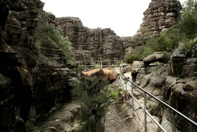
A railed walkway threading a narrow sandstone gorge below layered rock formations in central Gariwerd
  1. 01

    The name

    Gariwerd is the Aboriginal name for the range. The Djab Wurrung and Jardwadjali peoples have lived here for tens of thousands of years.

  2. 02

    Rock art

    The region holds the largest concentration of rock art in southern Australia — more than 80 per cent of Victoria's recorded sites. Around 60 art sites containing over 4,000 motifs have been identified within the park, and five shelters are open to the public.

  3. 03

    Landscape

    Rugged sandstone ranges — Mount Difficult (Gar), the Wonderland Range, the Serra Range and Mount William (Duwul) — rising from the Wimmera plains, with waterfalls, gorges and clifftop lookouts. National Heritage listed.

  4. 04

    The 2024–25 fires

    A lightning strike on Yarram Gap Road on 17 December 2024 began the first major fire. Further lightning-started fires on 27 January 2025 burned the western areas including the Victoria Range, Victoria Valley and Wallaby Rocks. In total roughly 135,000 hectares burned — close to 80 per cent of the park.

  5. 05

    Recovery

    Parks Victoria has led a staged recovery including predator control, monitoring of endangered brush-tailed rock-wallaby habitat and blackfish relocation, with Traditional Owners implementing strategic fire management to protect cultural sites. Most visitor areas have reopened; a few remain closed.

  6. 06

    Grampians Peaks Trail

    164 kilometres from Mount Zero in the north through Halls Gap to Dunkeld in the south — a 13-day walk, also walkable in sections. The full trail reopened on 2 March 2026 for the first time since the fires.

  7. 07

    Base town

    Halls Gap — cafés, a bakery, the Information Centre, and kangaroos that graze the town lawns at dusk.

What you can do

Written against what is actually open.

Times are how long you spend on the ground. Every entry is re-checked against the Parks Victoria road and closure report before your day is confirmed.

01

Central Gariwerd

The classic day-trip area · 8 stops

The lookouts, the falls and the walk everyone comes for, all within reach of Halls Gap — and realistically the only part of the range a day trip can cover.

The Pinnacle

The signature walk

Wonderland Range

On the ground · 1.5–3 hrs depending on route

The lookout that appears on every photograph of the Grampians — a rock platform hanging over the Fyans Valley with Halls Gap far below. Two routes: an easy-to-medium walk from Sundial Car Park, which is the sensible day-trip choice, or a harder route from Wonderland Car Park through the Grand Canyon and Silent Street, squeezing between rock walls and up staircases cut into stone. If you do one walk in Gariwerd, this is it. Sundial Peak Walk and The Bleachers are closed for bushfire track damage, but The Pinnacle Walk and Lakeview Lookout Walk from the same car park remain open.

Reed Lookout & The Balconies

Best reward per minute

Mount Victory Road · free

On the ground · 45–60 min

You can drive almost to the platform. Reed Lookout gives an enormous view over Victoria Valley, the Victoria and Serra Ranges, Lake Wartook and the Mount Difficult Range — and it is the best sunset position in the park. A short, easy walk continues to The Balconies, the jutting rock formation once known as the Jaws of Death, now viewed from a platform. Big-vehicle parking available, and suitable for almost every guest.

Boroka Lookout

Mount Difficult Road · free

On the ground · 30–45 min

Sealed access to platforms looking east over the Wonderland Range, the Mount William Range, Fyans Valley, Lake Bellfield and the plains beyond. A short, level walk from the car park — the accessible lookout of choice, and the natural pairing with Reed.

Silverband Falls

MacKenzie alternative

The open waterfall

On the ground · 45–60 min

A short, shaded walk to a fall dropping into a fern gully. Not as large as MacKenzie, but genuinely lovely and — critically for 2026 — open. Best after rain.

Venus Baths & the Halls Gap walks

From the town

On the ground · 1–1.5 hrs

An easy riverside walk from Halls Gap through the Botanic Gardens to smooth rock pools worn into the creek bed. Flat, shaded and family-friendly, and it starts where lunch is. The Chatauqua Peak (Bim) loop climbs from the same area, though sections have been subject to closure and detour — we confirm before it goes in the plan.

Mount Rosea & the Tunnel Walk

Reopened after fire recovery

On the ground · Rosea 3–4 hrs · Tunnel Walk under an hour

Mount Rosea is a serious ridge walk with exceptional views, for fit walkers. The Tunnel Walk is short and unusual — a natural rock tunnel worn by water. Both reopened as part of the staged fire recovery.

Lake Bellfield & Halls Gap

Town and water

On the ground · 60–90 min including lunch

Halls Gap is the natural base — cafés, a bakery, the Information Centre and a general store, with kangaroos on the lawns morning and evening. Lake Bellfield sits just south with picnic areas and a view straight up the ranges. Halls Gap Zoo, on the town's edge, holds native and exotic animals and works well for families.

MacKenzie Falls (Migunang Wirab)

Closed to end 2026

Not on any itinerary we build

On the ground · —

The most famous waterfall in the Grampians and one of the largest in Victoria, normally viewed from a platform or reached by a steep descent to the base. The entire precinct closed on 9 February 2026 for construction of a new base viewing platform, car park upgrades, rock stabilisation and track improvements, with works expected to run to the end of 2026. From May 2026 the base has also been inaccessible via the River Walk from Zumsteins. It is listed here so you know before you book, not because we will take you there — several tour operators are still advertising it. Silverband Falls is the alternative.

02

Northern Gariwerd

The rock · 5 stops

Bare sandstone, scrambling routes and the northern shelters. Harder country, thinner crowds, and the end of the range that looks least like anywhere else in Victoria.

Hollow Mountain (Wudjub-Guyun)

Open

On the ground · 1.5–2 hrs

A scramble up and into a wind-hollowed sandstone dome riddled with caves and overhangs, ending in a view across the Wimmera plains. Hands-on-rock in places and genuinely fun — the walk that converts people who thought they didn't like walking.

Mount Stapylton & the Stapylton Loop

Northern tip

On the ground · 2–3 hrs

Rocky ridgeline walking with big exposed slabs and long views — the most dramatic short section of the northern Grampians Peaks Trail. The Mount Zero (Mura Mura) trailhead upgrade is now finished and its car park has reopened with more parking, new picnic facilities and signage — though plenty of guides still list it as closed. Being dropped at the trailhead is still the difference between starting the walk and hunting for a space on a spring weekend.

Beehive Falls & Briggs Bluff

Roses Gap · both open

On the ground · Beehive 1–1.5 hrs · Briggs Bluff 4–5 hrs

A pleasant creek walk to a narrow fall, with the option to continue steeply to one of the best clifftop views in the north.

Zumsteins Picnic Area & Fish Falls

MacKenzie River

On the ground · Picnic 30 min · Fish Falls 1.5–2 hrs return

A historic settlement site on the river bank with barbecues, shade and wildlife. The walk upstream to Fish Falls is the best river walking in the park, graded 3. Parking at Zumsteins is limited while the MacKenzie Falls construction is underway, especially for larger vehicles on weekends — another reason a car that can drop and reposition matters here.

Golton Gorge, Mount Difficult (Gar) & Heatherlie Quarry

Northern walks · all open

On the ground · 1–5 hrs depending on choice

Golton Gorge is a short rocky scramble. Mount Difficult is a long full-day summit. Heatherlie Quarry is the sandstone quarry that supplied Melbourne's Parliament House, with ruins and machinery still in place.

03

Southern Gariwerd

The Dunkeld end · 4 stops

Named peaks rising straight out of farmland, and the quietest end of the range — a long way from Halls Gap on a day that is already long.

Mount Abrupt (Mud-Dadjug)

Grade 4 · 6.5 km return · reopened

On the ground · 3–4 hrs

A challenging climb to a summit with the southern ranges falling away on both sides — the finest view in the southern Grampians. Fit walkers only.

Mount Sturgeon (Wurgarri)

Grade 4 · 6.4 km · reopened

On the ground · 3–4 hrs

The southern end-point of the Grampians Peaks Trail, rising straight out of the plains above Dunkeld. Planned autumn burns have periodically disrupted the summit track, so we check the burn schedule.

Piccaninny (Baingugg)

Grade 3 · 2.5 km

On the ground · 1–1.5 hrs

A short, moderate hill walk close to Dunkeld with a disproportionately good view. The right southern walk when time is short.

Dunkeld & the Royal Mail Hotel

Southern gateway

On the ground · 90 min–2.5 hrs

A small town under Mount Sturgeon with one of regional Victoria's most celebrated dining rooms and an extraordinary cellar. A serious lunch or dinner stop that turns the drive home into part of the experience — but it books well ahead and adds significant time. Best on a 14-hour day or an overnight.

04

On the way

The Western Freeway corridor · 1 stops

The towns the road passes through — for the stop that breaks up three hours of driving in each direction.

Great Western, Stawell & Ararat

Western Freeway corridor

On the ground · 45–90 min

Great Western is one of Australia's oldest wine districts, with historic underground drives cut by gold miners at the region's founding wineries — a genuinely unusual cellar door experience, and almost exactly on the route. Stawell has the Information Centre and the last reliable fuel and food before the park. Ballarat, with Sovereign Hill, sits an hour out of Melbourne and is a legitimate alternative destination if the park closes on a fire danger day.

Aboriginal rock art

Five shelters are open to the public.

Gariwerd holds more than 80 per cent of Victoria's recorded rock art sites. These five can be visited, and the way you visit them matters.

These are living cultural sites. All five shelters are fenced to protect them from vandalism, and viewing is from a distance: stay behind the barrier, do not touch the rock, do not climb, and photograph respectfully. Aboriginal-guided experiences operate in the region and are the better way to visit these places — we recommend them rather than replace them.

Bunjil's Shelter

Directly on the route

Black Range Scenic Reserve, ~10 km south of Stawell · free

On the ground · 30 min

The only known rock art depiction of Bunjil, the creator being of many Aboriginal cultures across Victoria, shown in human form with his two dingo helpers. Bunjil is described as the principal legendary hero who provides for all and remains a protector of the natural world; when his creation work was done he transformed into a wedge-tailed eagle. It is widely regarded as one of the most significant cultural sites in south-eastern Australia. It sits just off the Stawell–Pomonal Road, essentially on the drive in from Melbourne, and the walk is only around 200 metres return via steps through boulders. Fenced — bring binoculars for the detail.

Gulgurn Manja Shelter

Hollow Mountain car park, northern Gariwerd

On the ground · 45 min

The name means "hands of young people". An easy self-guided walk of about a kilometre leads to a shelter whose ceiling carries bars, strokes, emu tracks and handprints — many made by children, pressed with ochre-painted hands rather than stencilled. Handprints of this kind are found only in northern Gariwerd. From here the Jardwadjali could see the fires of other groups out across the Wimmera plains. Pairs naturally with a Hollow Mountain walk.

Ngamadjidj Shelter

Wheelchair accessible

Near Stapylton Campground

On the ground · 20–30 min

A short circuit of roughly 100 to 300 metres — the only rock art shelter in Gariwerd accessible to wheelchairs and prams. Ngamadjidj means white person, and this is the only site in the park painted solely in white, using ground kaolin clay rather than the usual red ochre. Sixteen figures remain on the panel, some now very faint. It is sometimes called the Cave of Ghosts, though that name is a European invention and the meaning of the figures was lost before it could be recorded.

Billimina Shelter

Remote · check access

Victoria Range, from Buandik Picnic Area

On the ground · 1.5–2 hrs plus a long drive

The largest display of rock art in the Grampians — a massive overhang carrying more than 2,500 motifs, mostly vertical red ochre bar strokes, along with human-shaped figures. Once a meeting place and a staging post for seasonal movement into the mountains. Roughly 1.5 hours' drive from Halls Gap, largely on unsealed roads in the western section of the park, which was worst affected by the January 2025 fires. Realistically a two-day proposition rather than a day trip, and access has to be verified.

Manja Shelter

Remote · check access

Victoria Range · the Cave of Hands

On the ground · 1.5–2 hrs plus a long drive

Around 90 hand stencils recorded in an impressive sandstone outcrop, with animal tracks and human stick figures. Roughly a 20-minute uphill walk from the car park beside the Billywing Pine Plantation, about ten minutes on from Buandik. The same caveats as Billimina — remote, unsealed, fire-affected, and subject to periodic closures for recovery works.

Trip shapes

Five ways to spend the day.

One of them is not a day trip at all, and it is the one we would actually recommend.

12 hours · the honest version

The classic day

Depart early, Bunjil's Shelter on the way in, Boroka Lookout, lunch in Halls Gap, The Pinnacle from Sundial, then Reed Lookout and The Balconies before home. Two lookouts, one real walk, one significant cultural site.

  • Bunjil's Shelter
  • Boroka Lookout
  • Halls Gap
  • The Pinnacle
  • Reed Lookout
  • The Balconies

14 hours

The full day

Adds either Silverband Falls and Venus Baths, or a run north for Hollow Mountain and the northern shelters. Long — but the light at either end of the day is the best part.

  • Everything above
  • Silverband Falls and Venus Baths
  • or Hollow Mountain
  • or the northern shelters

14 hours

The walkers' day

The Pinnacle via the Grand Canyon route in the morning, lunch, then Hollow Mountain or Mount Rosea. Two serious walks, minimal sightseeing, and a well-earned sleep on the drive home.

  • The Pinnacle via Grand Canyon
  • Lunch
  • Hollow Mountain or Mount Rosea

12 hours

The cultural day

Bunjil's Shelter, the Brambuk Information Centre at Halls Gap, then Gulgurn Manja and Ngamadjidj in the north, with Boroka Lookout between. Slower, quieter, and the version most visitors never consider. Aboriginal-guided experiences operate in the region and are the better way to do this.

  • Bunjil's Shelter
  • Brambuk
  • Boroka Lookout
  • Gulgurn Manja
  • Ngamadjidj

The one we would actually recommend

The overnight

Halls Gap or Dunkeld. Sunrise at The Pinnacle, the southern peaks, the western rock art shelters, and dinner without a three-hour drive afterwards. Same travel, twice the park.

  • Halls Gap or Dunkeld
  • Sunrise at The Pinnacle
  • The southern peaks
  • The western shelters

About the length of the day

A 12 to 14 hour day with six hours of driving in it is the longest we run, and how it is staffed is not a detail. Tell us which shape you want when you enquire and we will confirm the day length and the driving arrangement in writing before you book.

When to go

Spring, by a clear margin.

The line at the foot of each panel is what that stretch of the year is actually for.

Sep–Nov

The premier season. More than a thousand wildflower species bloom across the ranges, waterfalls still run, and temperatures suit walking. Fire risk is low.

The best window by a clear margin. Book early.

Dec–Feb

Long daylight and the most usable hours in the park — but the highest fire danger of the year, and exposed summit walks get genuinely dangerous in heat.

Early starts, early finishes, and a real chance of a Total Fire Ban changing the plan.

Mar–May

Stable weather and good walking. Planned fuel-reduction burns are scheduled through autumn and can temporarily close tracks, roads and visitor sites at short notice.

Excellent, with a caveat — we check the burn schedule for your date.

Jun–Aug

Waterfalls at their strongest, dramatic cloud on the ranges, empty lookouts. Seasonal road closures apply, and daylight is short against a six-hour drive.

The most atmospheric and the most constrained. Fewest usable hours of the year.

Why book it this way

This is the trip where driver fatigue is a safety issue, not an inconvenience.

Six hours behind the wheel, most of it either side of a full day of walking, on roads with kangaroos on them at dusk. Here is honestly how the alternatives go.

Why trust us with the day

  • Licensed commercial passenger vehicle operator with a fixed-fare promise — the fare you see is the fare you pay, agreed before departure, on a day where fuel and distance would otherwise be a real cost.
  • We check the current Parks Victoria road and closure report for your date, and again on the morning of travel. On this destination that is not a nicety — it is the difference between a good day and a wasted one.
  • A Melbourne-based operator running regional Victoria work daily, comfortable with long distances and country roads.
  • Cabcharge accepted, and MPTP recognised.

Why not drive yourselves

  • 520 kilometres in a day. The return leg starts after a full day of walking, often in the dark, on a highway with wildlife active at dusk. This is the trip in our range where driver fatigue is a genuine safety issue rather than an inconvenience.
  • Mobile coverage is patchy through the park. A breakdown or a wrong turn is a different kind of problem out here.
  • Car parks at The Pinnacle and Zumsteins are constrained, and Zumsteins is tight for larger vehicles while the MacKenzie works run. Being dropped at the trailhead is worth an hour on a busy day.
  • You cannot walk a one-way route in your own car.

Why not a coach tour

  • Coach itineraries are locked months ahead, which is why several are still advertising MacKenzie Falls. We build against this week's closures.
  • You choose the walk and its difficulty. A coach group moves at the pace of its slowest member, on a trail where that matters.
  • Door-to-door from your hotel or address, not a 6.30am CBD assembly point.
  • Sunset at Reed Lookout is possible, because your car waits.

Why not public transport

  • There is a train to Ararat and a coach to Halls Gap, and that is essentially the end of it. Nothing connects the lookouts, the trailheads or the rock art shelters, which are spread across a park the size of a small country.
  • There is no same-day return that leaves any usable time in the park.

Why dates go early

  • Spring — the wildflower season and the best walking of the year — is the busiest window and the shortest.
  • A 12 to 14 hour hire commits a vehicle and driver for a full day and takes them out of the metro fleet entirely, so these dates go first.
  • Dunkeld's Royal Mail Hotel and Halls Gap accommodation both book well ahead.
  • Group and mobility vehicles are limited and must be reserved.

Vehicle and group

On a 520 km day the car is most of the experience.

Flex

1–3 guests

Workable, but this is six hours in the car — we would recommend going up a tier.

Our pick for 520 km

Plus

1–4 guests

Premium sedan or SUV. The default recommendation. On a 520 km day the vehicle is most of the experience.

Group

5–7 guests plus packs

People mover. The right call for walkers carrying gear, and for spreading the cost of a long day.

Mobility

Wheelchair passengers

Must be booked ahead. Gariwerd is more accessible than it looks — see below.

Gariwerd is more accessible than it looks

Boroka Lookout
Sealed, short and level from the car park.
Reed Lookout
You can drive almost to the platform.
Ngamadjidj Shelter
The only rock art shelter in Gariwerd accessible to wheelchairs and prams.
Zumsteins & Halls Gap
The picnic area and the town precinct are level and serviced.
Not suitable
The Pinnacle by either route, Hollow Mountain, the Grand Canyon, Mount Rosea, the southern peaks, and Billimina and Manja.
Worth asking about
Parks Victoria offers all-terrain wheelchairs at some locations — worth enquiring for a specific date.

Before you go

The practical part.

The things guests ring up about the night before — and two that are about how to behave, not what to pack.

Pickup

Door-to-door from any Melbourne hotel or address, typically 6.30 to 7.30am to make the day work.

Fuel and tolls

Included in the fixed fare. On a 520 km day that is worth stating explicitly.

Food

Halls Gap for lunch, Stawell for the last reliable supermarket, Dunkeld for a serious meal. Meals are not included — and Gariwerd rewards a packed lunch at a lookout.

Water

Carry more than you think. There is no reliable drinking water on most tracks.

Footwear

Proper shoes for The Pinnacle, Hollow Mountain or any summit. The rock is uneven and slippery when wet.

Mobile coverage

Patchy throughout the park. Download maps before you leave Stawell.

Wildlife

Kangaroos, emus and echidnas throughout, most active at dawn and dusk — which is exactly when we are driving. Slower is the plan, not a delay.

At cultural sites

All five shelters are fenced. Stay behind the barrier, do not touch the rock, and treat them as the living cultural places they are.

Stay on formed tracks

Much of the park is regenerating after the fires and the ground is fragile.

Questions

What guests ask before they book.

How far are the Grampians from Melbourne?

About 260 kilometres west, roughly three hours each way via the Western Freeway to Stawell and then the Grampians Road into Halls Gap.

Can you do the Grampians as a day trip?

Yes, and we run it — but be realistic. It is around 520 kilometres of driving, leaving five to seven hours in the park: two lookouts, one good walk and a rock art site. It is a real day out. If you want to see Gariwerd properly, stay a night in Halls Gap or Dunkeld.

Is MacKenzie Falls open?

No. The entire precinct — car park, Broken Falls Walk, the walk to the base, Bluff Lookout and parts of the River Walk — closed on 9 February 2026 for major construction including a new viewing platform at the base, with works expected to run to the end of 2026. Silverband Falls is the alternative and it is open.

Is the park still affected by the bushfires?

Yes, though most of it has reopened. Fires across the 2024–25 summer burned roughly 135,000 hectares — close to 80 per cent of the park. Staged recovery has reopened most visitor areas, and the full 164-kilometre Grampians Peaks Trail reopened on 2 March 2026. A few sites remain closed, and we check the current report before your day.

Where can we see Aboriginal rock art?

Five shelters are open to the public. Bunjil's Shelter near Stawell holds the only known rock art depiction of Bunjil, the creator being, and sits essentially on the drive in. Gulgurn Manja and Ngamadjidj are in the north and easy to reach; Billimina and Manja are in the remote western Victoria Range and realistically need an overnight. All are fenced and viewed from a distance.

Which walk should we do?

The Pinnacle. Take the easier route from Sundial Car Park for a moderate 1.5 to 2 hours, or the harder Wonderland route through the Grand Canyon if you are a confident walker. It is the view Gariwerd is known for.

What if there's a Total Fire Ban?

Park sites can close at short notice on extreme fire days. We check conditions the morning you travel, and Ballarat, Sovereign Hill and the Great Western wineries sit on the same road as a full alternative day. We agree with you what happens in that case when we quote, so you are never the person discovering a locked gate after a three-hour drive.

When is the best time to go?

Spring, September to November. Over a thousand wildflower species bloom, the waterfalls still run, and the walking weather is ideal. Winter is dramatic but brings seasonal road closures and short daylight against a long drive.

Is it accessible?

More than you would expect. Boroka and Reed Lookouts have sealed, near-level access, and Ngamadjidj Shelter is the only rock art site in Gariwerd suitable for wheelchairs and prams. Book a mobility vehicle and we will build the day around accessible stops.

What does it cost?

The day is quoted as a fixed fare before you book, based on the vehicle you need and how long the day runs. This is the longest day we run, so tell us your date, how many guests and which shape you want, and we will put a figure in writing. Fuel and tolls are inside it.

Plan the day

Ask us what’s open on your date.

We read the Parks Victoria report before your day is confirmed and again on the morning you travel, agree the fare before you leave, and you spend the day looking at Gariwerd rather than driving to it.

Park status, road reports, closure notices, walk grades and shelter information come from Parks Victoria, including the MacKenzie Falls revitalisation project notices, the Grampians Peaks Trail reopening, and the fire recovery project pages. Regional and cultural context comes from Visit Victoria and Visit Grampians. All statuses are current as at 25 August 2026 and are re-verified against the current Parks Victoria road report before quoting.